Translate

Sunday, August 31, 2014

Belfast (11,12/8)

Geoff guided us to the local station to catch a train into Belfast. After sorting out domestic issues and a quick visit to the impressive City Hall we decided to try and catch a hop-on-hop off bus. The one recommended was actually quite difficult to find. We managed to get tickets from a shop, but then were given different sets of directions from different people so we went round in circles while dodging the rain.

Belfast Castle and view over the Loch
Fortified Police Station
The tour was in a couple of parts. The first took us past Belfast Castle which is quite small, but has a great spot on the side of the hill overlooking the city. It then took us through the heart of the area which was affected by “The Troubles”. Antrim Road, Shankhill Road, Crumlin Road were names which were well known around the world for a while for the wrong reasons. Many of the police stations are still heavily fortified with high walls, razor wire and security cameras. There are murals throughout the area we drove through supporting both sides of the conflict, with the loyalist areas still decked out with Union Jacks everywhere. Since the peace process has begun there have been huge efforts to integrate Protestants and Catholics who live essentially side by side in many different ways but in particular by sending their children to multi-denominational schools, etc. We drove past the “Peace Wall” which was built to separate the two sides, the politicians reasoning that if they couldn't see each other, they wouldn't shoot each other!!  A sign that the peace process has worked is that some of the bombed out areas where housing was cheap are now being gentrified and money is moving into the area.
The provocation still exists

Our second tour missed out on going to the docks which were the lifeblood of Belfast for a long time. Belfast was famous for its shipbuilding (the Titanic was built here) and the two huge cranes are still there and are currently working to build and repair drilling rigs. We did however see the fine buildings at Queens University and the Queens Hospital where world leading cancer research is being carried out. One of its buildings was recently opened by Prince Charles who apparently commented afterwards that it was the ugliest building he ever had to open. Some wits have nicknamed this building “Camilla”.
"Camilla"

Our last stop in Belfast was the Ulster Folk and Transport Museum. We gave the transport part a miss as well as the Irish Dancing display and headed into the reconstructed village. Reminiscent of Sovereign Hill in Ballarat, it is a site where old buildings depicting different aspects of life amongst normal people have been rescued and shifted to. Sandie and Jeff were amazed at how much has been added to it since last they were there. The oldest buildings were 16th century fisherman's cottages, built of stone and wattle and daub. The “wattle” had ropes of straw woven between the wattle stakes before the daub was applied. There were several working exhibitions, one of weaving woollen fabric and another cooking soda cakes – very tasty. Jill got a copy of the soda cake recipe from the printer in the “village” so that she can try them at home.

Poteen anyone?
 Meanwhile, the police display had, amongst the usual uniforms and weapons, a “poteen” still which would have been highly prized. The policeman's life was not easy, and even his social life was controlled – he was not allowed to marry for five years after he joined the police force!


The drizzle curtailed our visit to the farm area so we had a quiet drink at one of Jeff's old watering holes, then headed for the airport to go back to Chester.

Into Dublin (10/8)

Jill and I went into Dublin proper by ourselves as the others had headed off to their respective homes. We were concerned about Ralph and Wendy as the remains of hurricane Bertha were still being felt (but they were OK). We took the train in, and a friendly local (with an aunt that lives in Ballarat) helped us purchase our tickets using their new ticketing system.

Queue for the Book of Kells
Sunday is probably not the best day to view Dublin as a lot of the shops were shut. We went to visit the Book of Kells, but there was a queue around three sides of the quadrangle and the weather was looking threatening, so we headed for the Archaeology Museum instead. That was closed until 2pm so we kept walking and found the National Gallery of Ireland which Jeff had recommended and waited the 10 minutes for it to open at noon. It was well worth it. Although very small by NGV standards, it had some fine works on display. We had a look at their collection of masterpieces and their Irish collection as well.

We then headed back to the archaeology Museum. This was great in that it was Irish archaeology rather than the Greek, Roman or Egyptian that we often see. Particularly interesting were the remains of four bog men (bodies that had been preserved in the peat bogs since neolithic times). The condition varied a little depending on the bog they were found in. One was only the tanned skin, since all the bones had been dissolved by the acidity of the bog. Another was mostly skeleton with little soft tissue remaining, and there was evidence of the way they had died which in each case was violent.
Trinity College Library - the Long Room
Another gallery was devoted to Brian Boru, who was the first king to rule all of Ireland and is a legendary figure in Irish history. It was interesting that there was a whole gallery relating to him, but there was actually very little hard evidence to corroborate the facts. The Irish being such great story tellers, it would be great to be able to separate fact and fiction.
We walked back through Trinity College on our way back to the train trying again to dodge the showers. This time there was no queue, so we walked straight in to the ticket booth. We still had to queue to see it and the Book of Darrow, but there were posters on the way in describing vellum preparation and ink and pigment production to improve our appreciation of the effort behind these works at that time. When we did get in the wardens kept us moving. Of course you only see the two pages of each at the place they are open, but that is enough to appreciate the craftmanship of the scribes who created it. You can see copies of it on line, but it is still great to see the real thing.
The exit from the Book of Kells takes you through the breathtaking Long Room of the library. It was built in 1732, is 64 metres long, and had its roof raised to accommodate the more than 200,000 antiquarian texts on its shelves. They receive a copy of each book published in the UK, but the later work is housed elsewhere.
Irish Crosses at
Monasterboice
I'll disappoint all the drinking fans by saying that we didn't go to the Guinness brewery – I did that the first time I was in Ireland, but I did partake of that brew a number of times in our travels.
We were too late to visit either Newgrange (a huge neolithic tomb 100m in diameter built around 3200BC with an internal chamber that is lit by the sun on the winter solstice making it the oldest known solar observatory) or the site of the Battle of the Boyne in 1690 between James II and his catholic supporters and William of Orange and his protestant army (a battle which is still a source of irritation especially in the north of Ireland as was seen just a few years ago, but more of that tomorrow).

A stop at Monasterboice taught us that the Irish cross has a ring in it because the pagan Irish were sun worshippers (understandably!) and to get them on side, Saint Patrick incorporated the sun into the symbol for the Christian cross, and there were two large examples in the little cemetery here. Jeff has a favourite pub with great meals here, but not knowing that we dined in Dundalk on the way back to Bangor.

Around Dublin (9/8)

Across the Wicklow Mountains
We headed off out of Dublin to Glendalough, the site of an old monastery, in the two smaller vehicles with the dogs as well. Selecting the type of route via GPS can be hazardous. The shortest route had us wending our way through housing developments and I'm sure it was the slowest as well! We eventually got onto the Military Road which was pushed through the heart of the Wicklow Mountains during the campaign to plush out Irish rebels (rebel – anyone not on your side) after ann uprising in 1798. The Wicklow mountains are treeless, covered by a vast expanse of blanket bog and heather. The heather was in flower, so areas of the mountains had a purple tinge to them. The trip was slow because it is a favourite area for the cyclists – they take their life into their hands and are not concerned about riding three abreast along the very narrow roads.
Restored? buildings at Glendalough
Glendalough is located in a beautiful steep-sided wooded valley containing two lakes, and looks like it was a glacial valley at some stage. There was a monastic settlement here established by St Kevin (a hermit) in the 6th century and although it was constantly sacked by the Vikings, it flourished for over 600 years. English forces razed some of the settlement in 1398 and the settlement started to decline from that time until the dissolution of the monasteries in 1539. It remained a place of pilgrimage for some time. Most of the buildings are thought to date from the 10th to 12th century and some were restored in 1870.
Having had a look at the buildings and cemetery near the car park, we walked around the first lake and found evidence of much older structures near the top lake. Time did not permit an interesting (but apparently more rugged) walk around the top lake or even rock-climbing on the crags above – a well known climbing area.
Powerscourt
We returned for a drink at the hotel, but couldn't compete for the waiters' attention against the tour buses so after half an hours waiting for our order to be delivered we just left and made do with what we had in the van.
After lunch we headed for Powerscourt, a stately home which was started in 1731 on the site of a Norman Castle. It was gutted by fire in 1974 and remained a shell until the Slazenger family bought it. They have developed an up-market shopping centre and restaurant on the ground floor, but it is the gardens which have pride of place. These gardens were established in 1875 by the 7th Viscount Powerscourt who brought decorative urns, statues and gates home from tours of Europe. The gardens, which are divided into “rooms” are again beautifully tended are inspirational for the ornamental gardener, and the associated nursery and plant shop are there to keep them happy. As it was late and the rain was threatening, we did a quick walk around and headed back to camp.
A celebratory meal

As Wendy and Ralph were heading back to Manchester the next day, we had a celebratory meal at a nearby restaurant “Carpe Diem” that Jeff and Sandie had discovered during one of their bridge tournaments. A good time was had by all.

Monday, August 25, 2014

Cashel on the way to Dublin (8/8)


Allan got a little damp on his run this morning. It looks like we will be in for a day of mixed weather. We travelled east today almost from one side of the country to the other.

Jill heading for the ruins on the rock
We all met up at in Cashel to visit a famous monastic site there. The Rock of Cashel, a very imposing site, had its origins as a fortress. Tradition has it that St Patrick baptised the grandsons of Conall Corc, the founder of the Cashell kingship, but it wasn't until 1101 that the site was given to the church. Brian Boru had defeated the original overking, whose seat it had been, in 1002, and by handing the Rock over to the church Boru made a very strategic move. Not only did he deprive his enemies of their ancient royal seat, but it also advanced his credentials as a church reformer. In 1111 the church in Ireland was divided into four territorial dioceses and has changed very little since that time.
The round tower


The buildings still standing on the rock date from several eras. The oldest is the round tower, thought to have been built in 1101. It is assumed that by 1111 Cashel would have had a relatively large church. Cormac's Chapel, (which was unfortunately closed and covered in scaffolding,) was built in 1134. It was built in the Romanesque style and is the earliest and best example in Ireland. Its original frescoes are under threat from damp, hence the restoration work going on at the moment. The remains of the cathedral are thought to be 13th century from its Gothic architectural style, but little is known about its construction and who built it. It was altered several times. Added to the site was a residential tower and Hall of Vicars Choral in the 15th century. The cathedral was sacked by the Parliamentarians in 1647 and its inhabitants massacred. It was still used by the Church of Ireland until 1749 when its cathedral status was transferred to St John's church in the town. Thus the site was abandoned and the cathedral fell into disrepair. Some conservation work was carried out in 1875, and in 1975 the Hall of the Vicars Choral was excavated, and then restored.


The frescoes being restored
On our way back to the vans for lunch, Sandie bought us a wonderful cartoon map of the sites as a momento of our holiday with them. After lunch we all headed for our last caravan park for the trip, just outside Dublin. 

Due to a mix up, we got involved in a traffic jam as a result of an accident which we could have avoided if we had set up the GPS correctly.  As usual, we enjoyed a great meal before turning in for the night.

The Ring of Kerry (7/8)

Apologies for the slow release of the blog.  We have had difficulty accessing the internet.

Sandie & Jeff declined to come on the Ring of Kerry drive as both had knee problems. We set off in an anticlockwise direction on the advice of the caravan park management as this is the direction the tour buses travel, and we wanted to avoid them as much as possible on the narrow roads. Our first diversion at Glenbeigh was to head for Rossbeigh for a walk along the sand spit. This stretch of sand heads approximately 2.5 km northwards towards the Dingle Peninsula, and almost opposite a spit from Inch which stretches south approximately 5km, the two of them forming Castlemaine Harbour. These impressive structures are very unstable, as in 2008, 400 metres of sand dune disappeared into the sea, while in 2011 the Rossbeigh Strand Tower which had been a marker for the harbour for over 100 years collapsed due to being undermined. It was estimated in 2013 that in the previous five years over 5 million tonnes of sand had disappeared from the sand spit. Obviously there are changes in the currents around the area and the means by which these unusual sand structures had been formed is now being reversed which is of concern not only to the locals (who are building rock walls to preserve their tourist attraction), but Castlemaine Harbour itself is a very important habitat for migratory wading birds.
The sand spit at Rossbeigh with the sea wall to protect it
We headed back to the main road via a very steep road only wide enough for one car, but fortunately there were passing places at frequent intervals. Having to back into one of these is obviously not unusual if a car is coming the other direction – which we were lucky enough to avoid.
The colours and variety of wildflowers in the
roadside verge were impressive
A little further along we diverted to take the ferry across to Valentia Island. We joined about 20 vehicles and a dozen or so bicycles for the 10 minute trip across and landed at Knightstown. This pretty little harbour town was not only the harbour for a small fishing fleet, but was being used by dozens of neoprene-clad children of all ages racing around both in and out of the water and using all sorts of different craft while seeming to yell at the tops of their voices. Several adults seemed to be trying to maintain some semblance of control.
Some of the children enjoying the summer camp

We found a map of the island and headed up to the highest point, Geokaun Mountain from where we could see the whole island – it is only 11km long by 3km wide. From there we could see to the north the slate mine which was one of the principle sources of income for the island. It was first opened in 1816 and found to provide a very good quality product was used for many notable buildings including Britain's Houses of Parliament, Westminster Abbey and Westminster Cathedral, St Paul's Cathedral and the Paris Opera (along with many billiard tables). It closed down in 1911 due to competition from the softer Welsh slate and a rockfall, and instead of staying to face a life of poverty, most of its employees chose to accept an assisted passage and emigrate to America. In fact after two ships sailed for the US, the school population fell from over 250 to just 56. The slate quarry reopened in 1998 with a very small workforce and provides its high quality stone for restoration work as well as new projects.
View north from Geokaun Mountain.  Slate mine under the brow of the hill.
Also to the north is the spot where in 1993 a student geologist discovered tetrapod tracks in Devonian mudstone believed to be 385 million years old and therefore amongst the oldest known traces of land vertebrates.
It was from this island that several attempts were made to lay the first transatlantic telephone cable, which was finally done successfully by Isambard Kingdom Brunel's steamship “Great Eastern” in 1866 with the shore station at this end being on the southern end of the island. This cable was so successful that it was in continuous use until it was decommissioned in 1966, exactly 100 years later.
The Skellig Islands from Geokaun Mountain
We returned to the mainland via the bridge at Port Magee, named after a notorious 18th century smuggler who worked in the area dealing in contraband spirits, textiles and tea and tobacco. We had lunch here on the sea wall soaking up the beautiful sunshine for a change. 
 From this port you can catch a boat out to the Skellig Islands (which we could see from Geokaun Mountain). It is only possible to land on the larger of these two very precipitous rocky islands and that with difficulty. For this reason, the monastery which was created there probably in 7th century and used for about 600 years has been naturally protected from desecration and is exceptionally well preserved. This UNESCO World Heritage Site shows the stone 'beehive' huts (clochans) perched above nearly vertical cliff walls which the monks lived in. The smaller of the islands is home to many seabird colonies.
Protected harbour at the western end of the peninsula.
Derrynane House was just off to the right.

The western end of the peninsula is quite indented, and at one stage we were able to look down on a couple of beautiful little bays with a large house off to one side. We later learnt that this was Derrynane House, the home of Daniel O'Connell who campaigned for catholic emancipation in the early 19th century. Catholics were not permitted to sit in the British Parliament for over 100 years until O'Connell, who trained as a lawyer and rose through the ranks against prejudice, had the laws overturned and entered parliament himself. He then worked towards the removal of Ireland from the United Kingdom. His tactics were mostly peaceful (although at one stage he was forced into a duel in which he killed his opponent), and led the way for Mahatma Gandhi and Martin Luther King Jnr.
View from Moll's Gap

Further on, we came to the lovely little town of Sneem, with its brightly painted buildings, but there were so many buses parked in the town square that we decided there would be too much competition for anything we might want to do or see so kept going, via the coast road, to Kenmare. Here Jill and Wendy found a lace museum, and the lady in attendance must have realised from their conversation that they had more than just a passing interest in it because she suddenly joined them and demonstrated at least five different styles of lacemaking, all Irish styles from different regions. Lacemaking is one of the projects Wendy intends taking up after retirement (in about four weeks time).  Nowhere looked enticing enough for coffee so we headed on to Moll's Gap which had both better coffee and better views.
The bus pushing its way through.

From here it was all downhill to Killarney. We stopped a couple of times for the view, dodging the buses which were also heading home. We were only trapped behind one bus (not a bad record).  It was amusing to watch it act like a bulldozer for us, making cars coming the other direct back off to allow it to negotiate a couple of the very tight bends on the narrow road. But the bus was not the only reason for our slow trip home. Despite the narrow roads and the traffic we passed numbers of cyclists all day. On this last stretch with traffic trying to go both directions it was very difficult to pass them, and so we travelled at cycling pace. This was not too bad behind the racing cyclists, but there were tourist cyclists on the road as well.
We went into Killarney for dinner at a pub that evening. Sandie and Jeff took a taxi (knees still a problem) while the rest of us walked to stretch the legs after the long drive. The taxi driver was asked to recommend a good place. He gave a couple of names, commenting that there were no bad ones as they would not survive. As we hadn't booked we only managed to find a table to accommodate the six of us on our third try. When Allan's shiraz order arrived, we were highly amused to see that it was an Australian wine, a small 185 mL bottle of Yellowtail – grown and matured in South Australia, bottled in Italy, imported into London, and drunk in Ireland! They also had kangaroo on the menu, but none of us took up that option. The walk back to the camp was a necessity after a very good meal.

Tuesday, August 19, 2014

Doolin to Killarney (6/8)

The remains of the castle at Adare
Our agreed lunchtime stop was Adare.  Heading off first enabled us to explore a little on the way.  In a number of areas we passed, it would appear that (just like in Australia) real estate has taken over from agriculture.  Some rather large residences have been built on what would originally have been small fields and they have large expanses of lawn around them.  Some of the farming land didn't look in the best of condition, and rather a large number of fields had been left fallow making us wonder about the viability of farming in the area.  Another indication was that the numbers of livestock were not great.
The tiny cloisters
Adare is quite a picturesque village  Indeed it has the reputation of being one of Ireland's prettiest, and therefore is very much on the tour coach agenda.  There are quite a few thatched cottages, and the shops are painted all the colours of the rainbow.  A castle (belonging to the Desmond family) was built here in the late 12th century to guard th ford across the river Maigue.  As its height, Adare boasted 3 monasteries, but Henry VIII found them and fleeced and destroyed them as he was inclined to do.
The church of the Augustinian priory, founded in 1316, was restored in 1807, and the refectory building was roofed in 1814 to become a schoolhouse which is
still functioning today.  It also had its cloisters, the smallest we have seen - only 10 metres by 10 metres.
We're not sure this is quite correct,
but they do provide a good service.

There is obviously a lot of craftwork done in the village as was indicated by the displays in the large information centre which also houses a small museum.  It could also be seen in the way the buildings in the village have been decorated.  Being a fine day for a change we enjoyed a drink outside one of the more colourful pubs in the village before moving on to Killarney via Limerick (in which we went round in circles a few times!)
The travellers at the priory
(minus the photographer of course)

.

Monday, August 18, 2014

The Cliffs of Moher (5/8)

Typical village - brightly painted, small shops,
cars parked facing any direction

Leaving Jeff behind with the dogs and the vans, the rest of us headed off for a walk along the Cliffs of Moher. We stopped off at Lahinch for supplies and a wander. It is a typical Irish village consisting of a series of narrow streets edged on both sides by narrow-fronted shops painted in any colour you can think of. And of course there were several pubs. As always there are several derelict places which probably haven't been touched since the great potato famine.


Looking for Napoleon


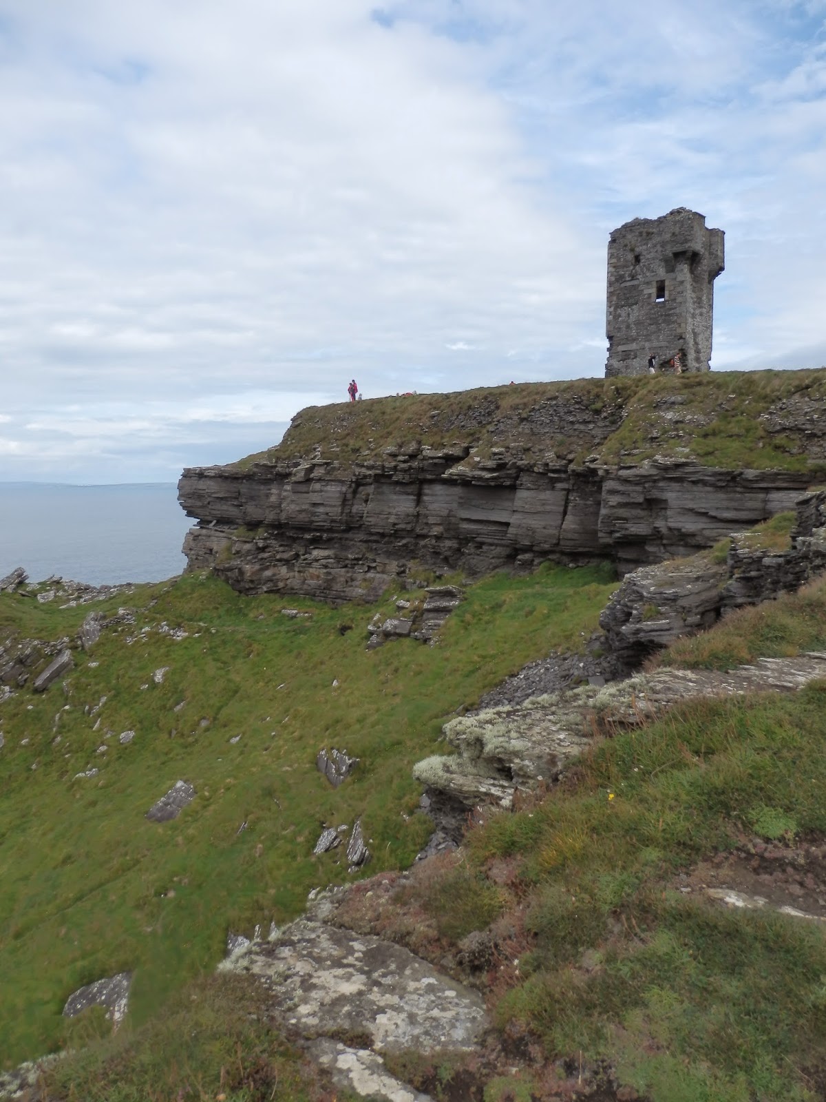
We left Sandie and her crook knee in the car and headed off aiming for a ruined tower on the cliff edge which was built in the Napoleonic era to signal in case of invasion


The view was spectacular, similar to the cliffs on the Great Australian Bight, but not as extensive. We only had a few minutes at the tower as we had a boat trip booked.  We could see where it would take us - the other end of the cliffs - as we could see a couple of the tour boats coming in
Tour boats under the cliffs.  Doolin in the background.
It started to drizzle as we boarded the boat and didn't really let up for much of the trip, but at least it was relatively calm. Ralph was sitting in the wrong position and copped the run-off from the roof of the cabin.  We went along the base of the cliffs and got in quite close them and to a sea stack as well. It was very atmospheric as there was a lot of cloud rolling over the tops of the cliffs.  The cliffs (over 210 metres high) of layers of black shale and sandstone towered above us. There were many seabirds roosting on the cliffs, but we didn't see the puffins which Jill was especially looking out for.
Cloud falling over the cliffs
Sea stack and sea birds


The next morning my run took me out along the cliffs from the camp at sea level so I got a good workout running up the steep path. I passed a tent pitched on one of the headlands – they were very exposed to any weather, but the view was spectacular!
Interesting campsite (running track off to the left - not along the rocks!)

Sunday, August 17, 2014

The Burren (4/8)

Not a bad view on the morning run


I had a good run along the coast from Rosses Point towards Sligo to maintain my goal of running at least every second day. It was a bit fresh, but at least it was dry.


After a communal breakfast, we headed off at our own pace. After several stops for photos, we pulled in to get some petrol and Wendy & Ralph pulled in soon afterwards. We lunched with them and followed them down the road to find a spot to go for a walk in the Burren. We ended up climbing Abbey Hill (240m).

The Burren is a limestone karst landscape scraped bare by glacial erosion, and then eroded to become a patchwork of a stepping stone-like structures called “clints” with eroded cracks being called “grykes”. The Burren covers about 300 sq km and compared to other karst areas is a relatively smooth landscape because of the relatively recent glacial action. (Most other karst areas only show the rock pillars which have not been eroded as would be expected after a very long period of erosion).  As you might expect with limestone country, below the surface is riddled with caves, many of which have never been explored.
Because the general surface of the clints was relatively even, the climb was fairly easy, although some of the smaller rocks were a bit unstable. We rock-hoppers enjoyed ourselves.

Because of the microclimates and geology of the grykes, plant species which are remnants of the ice age have been able to survive alongside plants which are from Mediterranean origin. The variety of flowering plants was huge, although the plants themselves were small, hiding away in the crevices. Those plants that did stick their heads up above the lip of the gryke were either growing prostrate, or had withered tops.


As the weather was clear, the view from the summit was brilliant looking out over Galway Bay with its many inlets, islets and small communities dotted about.
Galway Bay from Abbey Hill
Despite the rocky nature of the ground, fences have been built up to the top of this hill and the one opposite. So much effort for seemingly so little return, but then they were probably associated with the abbey after which the hill was named and the monks built them as part of their penance.  
The mandatory summit "selfie"
After our descent we headed off along the narrow roads to Doolin, one of the ports for ferries going to the Aran Islands.

Friday, August 15, 2014

Bangor to Sligo (3/8)

We travelled independently each day, but with specific rendezvous points chosen – either at a site of special significance or at the proposed camp-site. This meant that each could travel at their own pace. Jeff & Sandie's is a rather large 30ft “bus” which obviously had to stick to the larger roads, whereas Wendy & Ralph's more modest vehicle was able to tackle the narrower roads. Both were slower than our vehicle.  Travelling like this meant that we could each stop or detour where we wanted, however it was interesting the number of times we came across each other between planned stops.


Castle Coole
Our first planned stop was at Castle Coole, a National Trust property near Enniskillen.  It was a convenient distance along our planned route to have a break, and we caught up with Wendy & Ralph (who had left earlier than us) just before the turn off.
The "castle" is a large house built in the very severe "neo-classical Georgian" style (if you know what that means" designed by James Wyatt and commenced in 1789 for the Earl of Belmore.  There is no back door to the building at ground level.  All the deliveries and the servants entrance was via a long tunnel lined with store areas leading from near the stable area.
Wyatt was a pedant for symmetry, and throughout the rooms where there is a door, there is another directly opposite (or at least a false door).  

As was expected of people of their status in those days, a room was set aside for the king should he visit, but the planned visit never eventuated and so this room was decorated with a number of Hogarth's satirical cartoons poking fun at the aristocracy and in particular royalty.  I guess the family were allowing these to express their opinions.  Apparently the only person to ever use the room was an archbishop.

When the place was sold to the National Trust (to pay for death duties), all the furniture, a lot of which was Regency style, went with it and is considered reasonably rare.

The National Trust is working on restoring the servants quarters and the service areas which are probably the more interesting parts of the building as they were critical to the functioning of the formal life, but were kept very much out of sight.

The Australian connection with the place is that the 4th Earl Belmore was Governor of New South Wales 1868-1872 and there is a suburb in Sydney named after him.

At some stage we crossed over the border into Ireland, but we didn't see any signs to say where the border was.  We suspect we were looking elsewhere.  We just noticed that suddenly the speed signs were in kilometres rather than miles, and that the markings along the edge of the road were in yellow rather than white.  No border control, no passport check, no customs, nothing!!


The campsite and view.
The team consist of the brown "bus", the car to the right of it
and the camper immediately to the right
of the VW in the foreground
The trip down to Rosses Point (just past Sligo) to a campsite our friends have used before was along green valleys, past waterfalls (fed by the heavy rain showers we experienced.  The last part in particular was down narrow roads with trees overhanging so much they formed a complete arch.


May be difficult to see but a person is swimming
at the other end of the beach!
(The 3 girls & the dogs in the foreground)
The campsite was the antithesis of those we normally prefer.  It had no shade at all (not a problem in this weather) but a great view out across the water.  


Despite the weather, there were a couple of people in swimming - the Irish must be desperate!

Thursday, August 14, 2014

Ireland - Giant's Causeway (2/8)

We are to spend just over a week exploring Ireland with friends (Sandie & Jeff - and their miniature schnauzers - and Wendy & Ralph) from Allan's university days in London.  We will be using their motor homes and our hire car to get around.
Everyone over here has been telling us what a good summer they have had, but for our first day in Ireland it absolutely poured!  Despite that we headed for the Giant's Causeway hoping for a break in the weather.
The area is not as big as expected, but the basalt is obviously a lot tougher than that at the Organ Pipes near Melbourne as they have to withstand the nasty weather.
Despite the rain, and because we had come all that way, we went and had a look - and got soaked for our efforts.  It took a few days for our shoes to dry out.
Heading down to the area - the black rocks just beyond
the figures on the path

As you might expect, there were many tourists
at the site - despite the weather

The height here is about the same as the
Organ Pipes near Melbourne


Three of the drowned rats!

Wednesday, August 13, 2014

Old & New Technology


In England and Ireland in our first couple of days we have been interested in some of the technology we have seen, so I'll share a couple that we have managed to photograph.


The first we saw in Chester.  It was one of the aircraft modified to carry parts of the airbus A380 between the various manufacturing sites.  It looks like a huge beluga whale.  This one was photographed through the windscreen of the car as we were driving along and as you can see, we have power lines through the middle of it.  We almost missed it.


As we were driving in Northern Ireland we were held up behind this guy riding along on his bike while pushing a motor mower.  He wasn't particularly successful at it as he fell off a number of times.  We deliberately stayed behind him until we could get this photograph.  Throughout our trip in Ireland, the traffic was held up by cyclists, even on main roads.  The roads are so narrow that it is impossible to get off to the side, so you just have to wait.  Of course there were cycle races (rain, hail or shine) which held us up as well.

Ireland is known for its horse racing, and there are racecourses everywhere.  I think I only noticed one trotting track, but of course you have to exercise the horses somewhere, so why not along the road to the pub!


The Irish fishing fleet is not nearly as large as it used to be, but there are still a lot of fishing boats around.  They need to be pretty tough to put up with the weather in the Irish sea.


We saw this strange looking contraption off Portaferry (N.I.) at the entrance to Strangford Lough.  It wasn't being used at the time, so you can see the workings.  It is a tidal-powered electricity generator. As you might be able to see, it has two propellors on the end of each of its arms which are lowered into the tidal race between the sea and the Lough.  For the technically minded it is a twin rotor 1.2MW SeaGen and it generates 10MWh of energy.  It was installed in 2008.  For more information (and a clearer picture) see http://www.seageneration.co.uk.  At least one other tidal generator is being trialled here as well. http://en.wikipedia.org/wiki/Evopod